
Where Bihar has built.
Look around nine cities and six places, and follow the estimated spread of buildings through time. The final two years are projections.
THE BUILT LANDSCAPE / 1975—2030
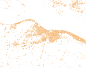
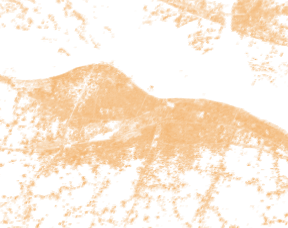
A place, seen over time.
Each view covers the same fixed window around a recorded place. Lighter marks indicate more estimated built-up surface within each grid cell.
A SEPARATE POPULATION MODEL
How many people in this area?
GHS-POP estimates the number of people in an area around the selected place. Choose a year to see the modelled distribution change.
This approximate grid window is not a city or district total. These are model estimates; 2025 and 2030 are projections.
34,88,994 modelled people in the grid window · 2020 historical estimate
GHS-POP source and citation ↗ · Processing and source hashes ↗ · CC BY 4.0 ↗
About this population grid
The population grid is coarser than the built-up layer and its pixel-aligned window differs slightly. Schiavina, Freire, Carioli and MacManus (2023), European Commission Joint Research Centre, doi:10.2905/2FF68A52-5B5B-4A22-8F40-C41DA8332CFE. Derived windows and colour rendering by Bihar Unpacked.

What is this showing? Sources and method
These images are derived from the European Commission Joint Research Centre’s GHS-BUILT-S R2023A grid. Its five-year time series combines satellite-derived anchor observations with interpolation and extrapolation. The 2025 and 2030 layers are projections from the 2023 release, even though a selected year may have passed. A bright cell estimates built-up surface within that cell; it does not show individual buildings or a precise settlement edge.
The window around each sourced place point is approximately 0.24° by 0.19°; it is not an administrative city boundary. Comparisons across years use the same grid window and colour scale. Numbers are sums of the grid’s square-metre values within the window. Zero is not interpreted as water, farmland or an absence of people. Different places cover different windows.
GHS-BUILT-S dataset and method ↗ · Reuse and attribution ↗ · Processing details and source hashes ↗
Pesaresi, M. and Politis, P. (2023), European Commission, Joint Research Centre, doi:10.2905/9F06F36F-4B11-47EC-ABB0-4F8B7B1D72EA. City reference nodes © OpenStreetMap contributors, ODbL; other points are from the site’s sourced road-stop registry. Reference points are not city boundaries or public entrances.